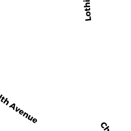
1874 COMMONWEALTH AV 12A
Owner Information
M & F REALTY TRUST
1321 UPLAND DR #1121
HOUSTON, TX 77043


Property Details
1874 COMMONWEALTH AV 12A is classified as a Residential Condominium (Low rise).
The primary structure on this property was built in 1950. There is 580ft2 of residential/living space within this property. This property is listed as having 3 rooms.
1874 COMMONWEALTH AV 12A is valued at $318,500. The land is valued at $0 and the structures are valued at $318,500.
The most recent deed for 1874 COMMONWEALTH AV 12A is recorded at the local registrar in Book 54629, Page 312. 1874 COMMONWEALTH AV 12A was last sold on Friday, June 19, 2015 for $280,000.
Assessment data from fiscal year 2020.
Flood Data
According to the FEMA National Flood Hazard Layer, this property does not appear to be in a flood zone. It may also be in an area not yet reviewed. Nonetheless, confirm this information prior to taking any action.
To view the flood hazards around this property, create a FEMA "Firmette" Map of the area around 1874 COMMONWEALTH AV 12A.
Broadband Internet Providers
| Provider | Type | Bandwidth (mbps) | |
|---|---|---|---|
| GCI Communication Corp. | Satellite | 0 | 0 |
| T-Mobile | Fixed Wireless | 25 | 3 |
| Starry, Inc. | Fixed Wireless | 200 | 200 |
| Viasat Inc | Satellite | 100 | 3 |
| Verizon New England Inc. | DSL | 15 | 1 |
| Verizon New England Inc. | Fiber | 940 | 880 |
| Comcast | Cable | 1000 | 35 |
| VSAT Systems, LLC. | Satellite | 2 | 1 |
| HughesNet | Satellite | 25 | 3 |
Broadband service provider data from December 2020.
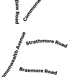
Adjacent Properties
- 9 BRAEMORE RD 8
Residential Condominium owned by IGO MARY - 9 BRAEMORE RD 10
Residential Condominium owned by WANG XIAOJING - 9 BRAEMORE RD 11
Residential Condominium owned by EMERY JADA - 9 BRAEMORE RD 12
Residential Condominium owned by ADILI YASMAN - 9 BRAEMORE RD 2
Residential Condominium owned by PASSAVANT ANDREA L - 9 BRAEMORE RD 13
Residential Condominium owned by GOLDTHWAITE DORIS E - 9 BRAEMORE RD 14
Residential Condominium owned by SUSKAWICZ DONNA - 9 BRAEMORE RD 1
Residential Condominium owned by LACK TAYLOR P - 9 BRAEMORE RD 3
Residential Condominium owned by SANT GARY - 9 BRAEMORE RD 4
Residential Condominium owned by ROTHENBERG SANDRA R - 9 BRAEMORE RD 6
Residential Condominium owned by LIRO BARTON T - 9 BRAEMORE RD
Other, Open Space owned by NINE BRAEMORE ROAD CONDO TR - 9 BRAEMORE RD 7
Residential Condominium owned by GUALDONI ANNABELLA L - 9 BRAEMORE RD 9
Residential Condominium owned by DARDENO RONALD A - 9 BRAEMORE RD 5
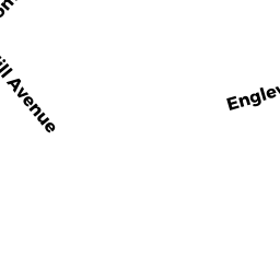
Residential Condominium owned by RUPANI KEN - 141 ENGLEWOOD AV 26
Residential Condominium owned by BOIKO KAREN R - 141 ENGLEWOOD AV 141-45
Residential Condominium owned by HOFFMAN THOMAS G - 145 ENGLEWOOD AV 145-26
Residential Condominium owned by GIBBONS THOMAS J - 137145 ENGLEWOOD AV
Other, Open Space owned by ENGLEWOOD CONDOMINIUM TR - 141 ENGLEWOOD AV 141-C
Residential Condominium owned by ROSEN BARBARA R - 141 ENGLEWOOD AV 141-1
Residential Condominium owned by HO JAMES K - 141 ENGLEWOOD AV 141-1A
Residential Condominium owned by YOGENDRAN CHANDRA - 141 ENGLEWOOD AV 141-3
Residential Condominium owned by NAGALINGAM VASUDEVAN - 141 ENGLEWOOD AV 141-21
Residential Condominium owned by KRAMER DARIO - 141 ENGLEWOOD AV 141-22
Residential Condominium owned by NEHRING ILSE - 141 ENGLEWOOD AV 141-23
Residential Condominium owned by HARDY JOHN J - 141 ENGLEWOOD AV 141-24
Residential Condominium owned by BRIGGS WILLIAM - 141 ENGLEWOOD AV 141-27
Residential Condominium owned by LING JIANJING - 141 ENGLEWOOD AV 141-28
Residential Condominium owned by PORTAS PAUL FARO-VIANA - 141 ENGLEWOOD AV 141-31
Residential Condominium owned by VAGAL PRATIBHA - 141 ENGLEWOOD AV 141-32
Residential Condominium owned by PENA MARTA R - 141 ENGLEWOOD AV 141-33
Residential Condominium owned by BOSTON MBM PROPERTIES LLC - 141 ENGLEWOOD AV 141-34
Residential Condominium owned by YANDOH EMILY A - 141 ENGLEWOOD AV 141-35
Residential Condominium owned by EARNBERG ELA - 141 ENGLEWOOD AV 141-36
Residential Condominium owned by SCHAAF JASON - 141 ENGLEWOOD AV 141-37
Residential Condominium owned by KONAK SEMMI SUPHI - 141 ENGLEWOOD AV 141-38
Residential Condominium owned by FERDMAN ARIEL G - 141 ENGLEWOOD AV 141-41
Residential Condominium owned by MOSKOWITZ ALEX - 141 ENGLEWOOD AV 141-43
Residential Condominium owned by MCGOWAN CHARLOTT TS - 141 ENGLEWOOD AV 141-44
Residential Condominium owned by COWLES CRYSTAL - 141 ENGLEWOOD AV 141-47
Residential Condominium owned by SILVERMAN BRET - 145 ENGLEWOOD AV 145-1
Residential Condominium owned by CHAN SEA WING CAROLINE - 145 ENGLEWOOD AV 145-1A
Residential Condominium owned by DABAGHYAN MIKAYEL - 145 ENGLEWOOD AV 145-1B
Residential Condominium owned by BROUSSEAU GABRIELLE ANNE - 145 ENGLEWOOD AV 145-2
Residential Condominium owned by GOLDBERG DANIEL J - 145 ENGLEWOOD AV 145-3
Residential Condominium owned by LT REALTY TRUST - 145 ENGLEWOOD AV 145-4
Residential Condominium owned by GU ZHENGYU - 145 ENGLEWOOD AV 145-5
Residential Condominium owned by DOMINGUES HEBER - 145 ENGLEWOOD AV 145-22
Residential Condominium owned by GONG QIUHONG - 145 ENGLEWOOD AV 145-23
Residential Condominium owned by FARIA MARIA - 145 ENGLEWOOD AV 145-24
Residential Condominium owned by LATORES SANTO J TS - 145 ENGLEWOOD AV 145-25
Residential Condominium owned by YANNATOS DIONYSIOS - 145 ENGLEWOOD AV 145-27
Residential Condominium owned by MIROSHNICHENKO SERGEI - 145 ENGLEWOOD AV 145-31
Residential Condominium owned by KRAMER JAYNE - 145 ENGLEWOOD AV 145-33
Residential Condominium owned by BOUSQUET JAMES J - 145 ENGLEWOOD AV 145-34
Residential Condominium owned by SONG NAREE - 145 ENGLEWOOD AV 145-37
Residential Condominium owned by SPUNT DOVSHE ADRIANE - 145 ENGLEWOOD AV 145-43
Residential Condominium owned by CLARK DEBORAH DUFFY - 145 ENGLEWOOD AV 145-44
Residential Condominium owned by WANG YUNG JUI - 145 ENGLEWOOD AV 145-47
Residential Condominium owned by SERPINSKAYA ALEXANDRA - 145 ENGLEWOOD AV 145-41
Residential Condominium owned by HU WEIYI - 145 ENGLEWOOD AV 145-42
Residential Condominium owned by ARADO MARIA T - 137 ENGLEWOOD AV 137-A
Residential Condominium owned by CLANCY ANNE L - 137 ENGLEWOOD AV 137-1
Residential Condominium owned by MURPHY KATHLEEN A - 137 ENGLEWOOD AV 137-2
Residential Condominium owned by SHIKH IGOR A - 137 ENGLEWOOD AV 137-4
Residential Condominium owned by WONG WUCK BUN - 137 ENGLEWOOD AV 137-21
Residential Condominium owned by POTAGAL GARY J TS - 137 ENGLEWOOD AV 137-22
Residential Condominium owned by CHEN YONGZHI - 137 ENGLEWOOD AV 137-23
Residential Condominium owned by 137 ENGLEWOOD AVENUE REALTY TRUST - 137 ENGLEWOOD AV 137-24
Residential Condominium owned by LESLIE J GREENFIELD - 137 ENGLEWOOD AV 137-25
Residential Condominium owned by ZHU YNYAN - 137 ENGLEWOOD AV 137-26
Residential Condominium owned by ASHER KAPIL V - 137 ENGLEWOOD AV 137-27
Residential Condominium owned by GRIFFIN JOHN - 137 ENGLEWOOD AV 137-31
Residential Condominium owned by HAMAMI TOMER - 137 ENGLEWOOD AV 137-33
Residential Condominium owned by POBEREZHSKY ALLA - 137 ENGLEWOOD AV 137-37
Residential Condominium owned by SAJI MICHAEL - 137 ENGLEWOOD AV 137-41
Residential Condominium owned by ORTIZ LUCIA P - 137 ENGLEWOOD AV 137-42
Residential Condominium owned by KOLTOV VITALY - 137 ENGLEWOOD AV 137-43
Residential Condominium owned by BELKIN ALEXSANDR - 137 ENGLEWOOD AV 137-44
Residential Condominium owned by SHILO SIMON - 137 ENGLEWOOD AV 137-45
Residential Condominium owned by WEGMAN ELIZABETH A - 137 ENGLEWOOD AV 137-46
Residential Condominium owned by SILFEN KATE L - 137 ENGLEWOOD AV 137-47
Residential Condominium owned by TOKAREV STANISLAV O BE - 141 ENGLEWOOD AV 141-A
Residential Condominium owned by BALDER BRUCE - 141 ENGLEWOOD AV 141-B
Residential Condominium owned by MCCAULEY DAYNA L TS - 137 ENGLEWOOD AV 137-5
Residential Condominium owned by PATEL PINAKIN J - 145 ENGLEWOOD AV 145-46
Residential Condominium owned by GORDON ROBERT H - 137 ENGLEWOOD AV 137-3
Residential Condominium owned by PLACID LLC - 137 ENGLEWOOD AV 137-36
Residential Condominium owned by KYZY AIKANYSH SYRGAK - 141 ENGLEWOOD AV 141-25
Residential Condominium owned by AVERY VIVIAN E - 145 ENGLEWOOD AV 145-35
Residential Condominium owned by CHAN SEA WON ELLA - 145 ENGLEWOOD AV 145-45
Residential Condominium owned by HOSSAIN MOHAMMED N - 141 ENGLEWOOD AV 141-42
Residential Condominium owned by CLANCEY PAMELA J - 137 ENGLEWOOD AV 137-35
Residential Condominium owned by AGUILERA PAULA - 141 ENGLEWOOD AV 141-2
Residential Condominium owned by MARKOV ALEXEY - 145 ENGLEWOOD AV 145-36
Residential Condominium owned by COHEN LIZA B - 145 ENGLEWOOD AV 145-21
Residential Condominium owned by FANG KAI-HUNG - 141 ENGLEWOOD AV 141-46
Residential Condominium owned by PICARDAT AURORA - 137 ENGLEWOOD AV 137-32
Residential Condominium owned by KLEMENT STEFAN HAIM TS - 137 ENGLEWOOD AV 137-34
Residential Condominium owned by O'HARA NICHOLAS J - 141 ENGLEWOOD AV 141-48
Residential Condominium owned by BARNICLE ROSS P - 145 ENGLEWOOD AV 145-32
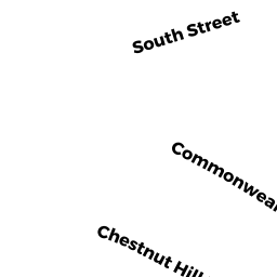
Residential Condominium owned by WONG REALTY TRUST - 332 CHESTNUT HILL AV
Gasoline Service Stations - providing engine repair or maintenance services, and fuel products owned by PECTEN PROPERTIES LLC MASS LLC